Kareri Lake Trek: Distance, Route, Rules & Best Time
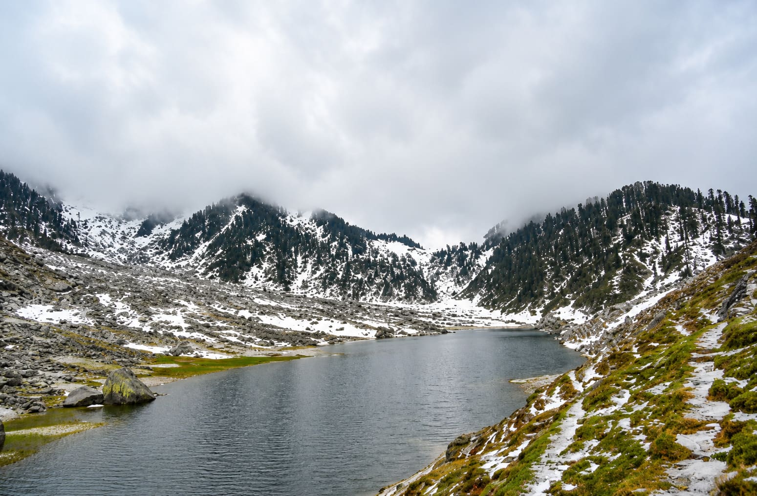
The Kareri Lake trek is 10 to 13 km one way from the trailhead — about 20 to 26 km there and back — at a height of 2,934 m (9,626 ft), and most people walk it over two days. The lake is frozen from early December until March or April.
Search it and you'll get 14 km, 9 km, 26 km and 27 km on one screen. They're measuring from different starting points and not saying so. Here's everything, sorted.
At a glance
| Distance | 10–13 km one way · 20–26 km return |
| Height | 2,934 m (9,626 ft) |
| Time | 2 days, 1 night |
| Difficulty | Moderate |
| Season | Late April to November |
| Trailhead | Kareri village, ~25 km from Dharamshala |
| Permit | None |
| Cost | Free on your own · ₹1,500–5,500 guided |
Kareri Lake trek distance
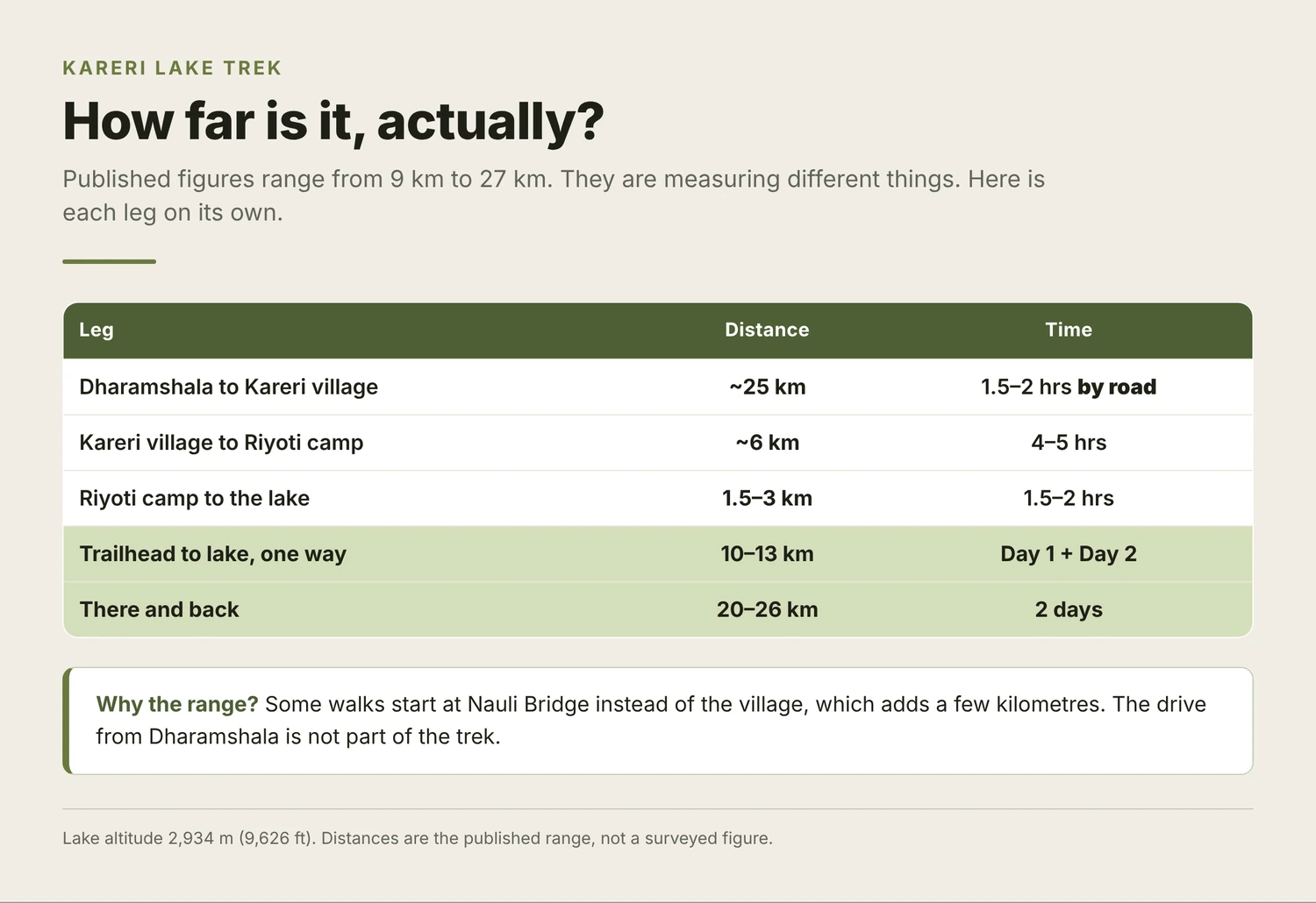
The Kareri Lake trek is 10 to 13 km one way and 20 to 26 km return from Kareri village. Published figures disagree because each one starts counting somewhere different.
| Leg | Distance |
|---|---|
| Dharamshala → Kareri village | ~25 km (a drive) |
| Kareri village → Riyoti camp | ~6 km |
| Riyoti camp → the lake | 1.5–3 km |
| Trailhead → lake, one way | 10–13 km |
| Return | 20–26 km |
Two honest notes most pages skip. Some walks start at Nauli Bridge rather than the village, which adds a few kilometres — that's where the 13 km figures come from. And the stage figures don't quite add to the totals even in Google's own summary, because nobody has measured this trail properly.
Riyoti is also spelled Reoti, Reyot and Liyoti. Same meadow, same camp.
How difficult is Kareri Lake trek?
Moderate — harder than Triund, nowhere near a pass. Not the one to start on: a beginner's guide to a first trek has the easier options.
- Well-marked trail, no ropes, no scrambling
- Roughly 5 km through forest, climbing steadily alongside a stream you cross more than once
- The last pull to the lake is the steep part, and it arrives when your legs are done
- 2,934 m is low enough that altitude sickness is unlikely
Fine as a first overnight trek if you've walked a full day before.
Kareri or Triund — which should you do?
The question everyone asks, so here it is straight.
| Kareri Lake | Triund | |
|---|---|---|
| Distance | 10–13 km one way | 9 km one way |
| Height | 2,934 m | 2,850 m |
| Time | 2 days | Day trip |
| Crowds | Quiet | Busy, capped at 400/day |
| Entry fee | None | ₹100 + ₹275 to camp |
| Guide | Optional | Compulsory for visitors |
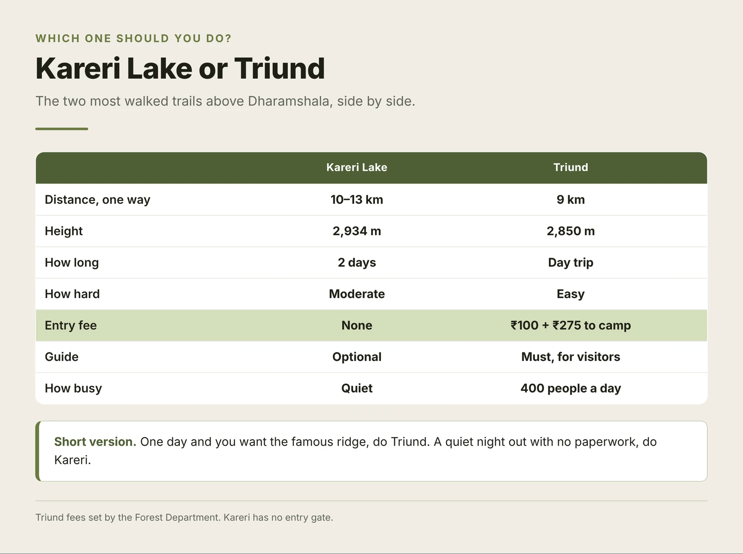
Do Triund if you have one day, want the famous ridge, and don't mind company. Do Kareri if you'd rather sleep somewhere quiet and skip the paperwork. Full details in the Triund trek guide.
Can you do Kareri Lake in one day?
Yes, and most people shouldn't. Twenty-odd kilometres with a climb in the middle is a ten to twelve hour day. You'd reach the lake, look at it for twenty minutes and turn round.
The lake is best at dawn, which means sleeping at Riyoti, which means a tent.
 Day-trip it only if you're fit, you start by 6am and somebody knows your plan.
Can you reach Kareri Lake by car?
No. The road ends at Kareri village. Everything above that is on foot — there is no jeep track, no pony road and no shortcut to the lake.
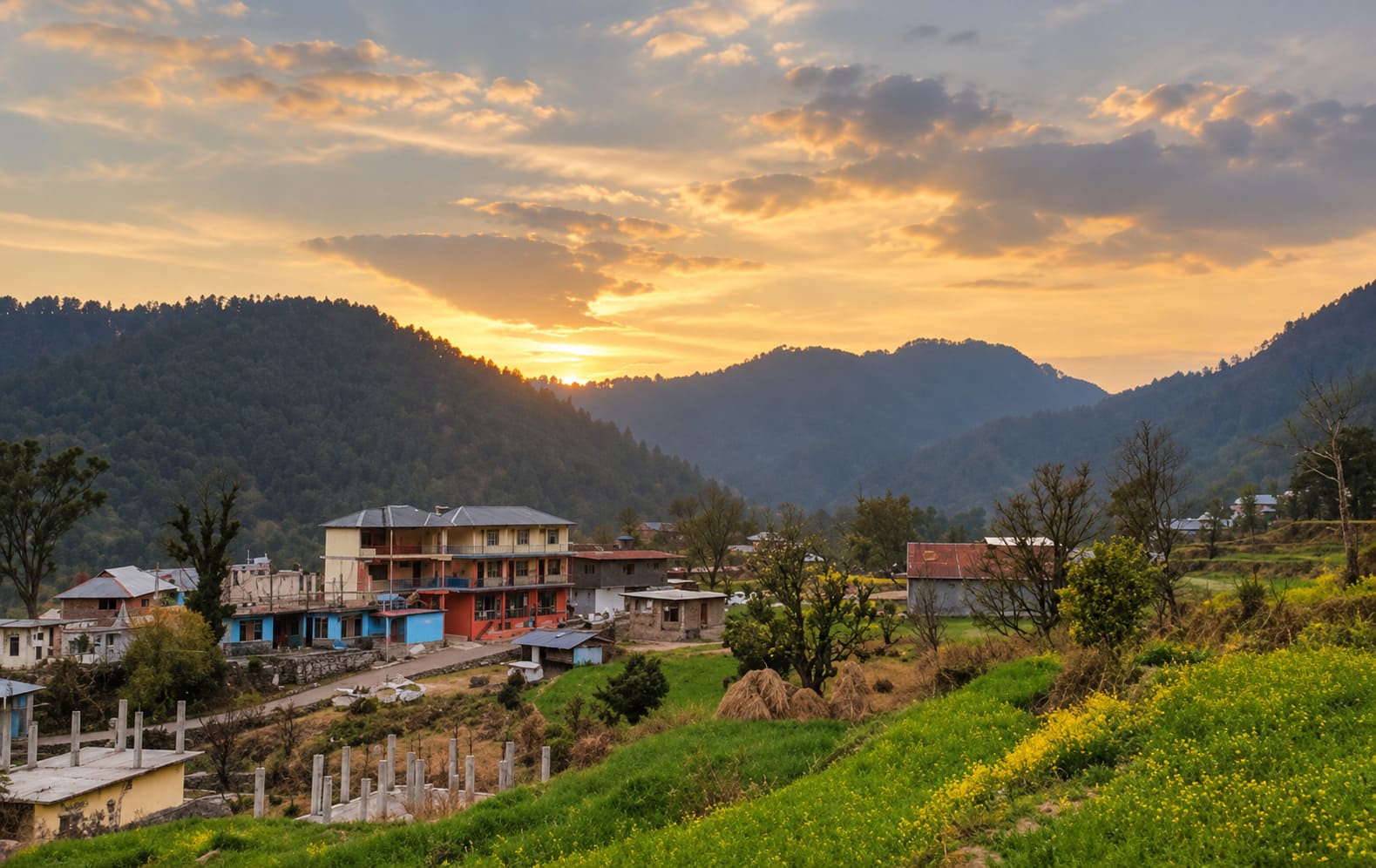
Getting to the village is about 25 km from Dharamshala, an hour and a half on a rough road. Buses run, slowly, for around ₹50; a taxi is ₹600 to ₹1,000 and worth splitting. Nearest airport is Gaggal. If you're building a longer trip around it, the places worth your time in Dharamshala covers the non-walking half, and Bir Billing is 70 km east.
Is the Kareri Lake trek open right now?
The Kareri Lake trek is open year-round except during winter closures, and needs no permit or entry fee.
There is no check post at Kareri village. The Kangra district administration put ten trekking check posts up in November 2025 — Salli, Nauhli, Gallu Temple, Khadota, Kand Kadiyana, Jiya, Thala, Nanahar, Uttarala Power Project and Rajgundha — and walking past one without registering can mean legal action under the Disaster Management Act.
Kareri isn't on that list. No fee, no permit, no paperwork. It also means nobody has a record that you went up, which matters more than it sounds on a two-day walk.
Khadota on that list is Kharota — the Thatharana trek trailhead, spelled differently on almost every page that mentions it. Worth knowing if that's your next one.
What does close it:
- Winter. The district has twice banned trekking above 3,000 m outright — November 2024 and again January 2026. Kareri sits at 2,934 m, just under that line, but both orders named it specifically as needing written permission from the SP Kangra while they stand
- Those orders lapse quietly rather than being lifted, so ask in the village if you're going in December or January
- Monsoon, when the stream crossings are the problem, not the rain
District-wide, a guide may lead no more than ten people, and GPS tracking is expected on organised expeditions. The other sixteen walks around Dharamshala are in the pillar guide.
The route, stage by stage
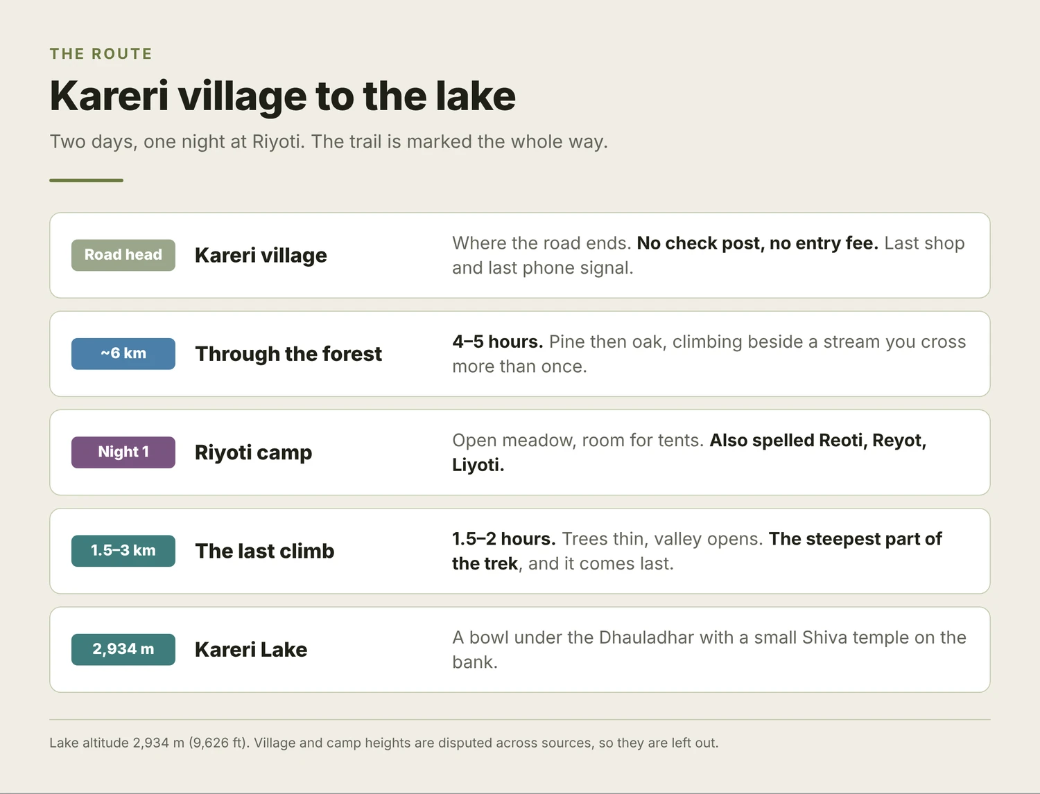
The walk starts where the road gives up, at the top end of Kareri village.
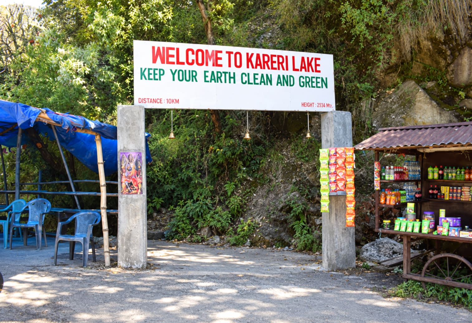
Kareri village → Riyoti · ~6 km · 4–5 hrs. Out of the village into pine and oak, stream on your right. The long, shaded half. Riyoti is an open meadow with room for tents.
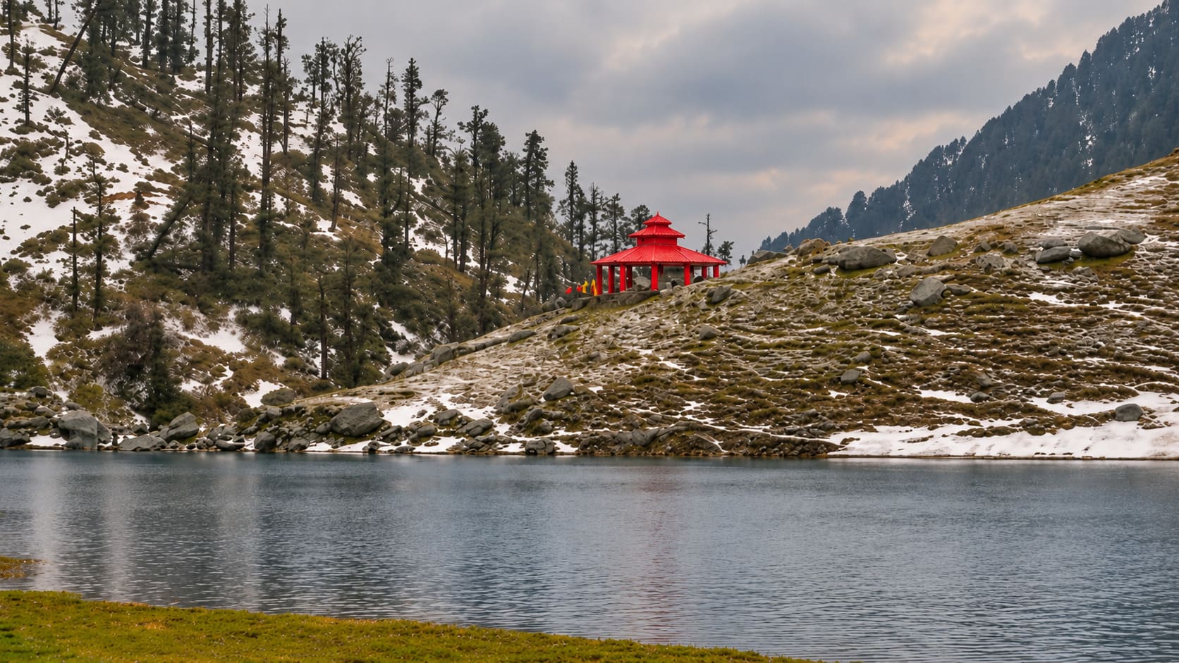
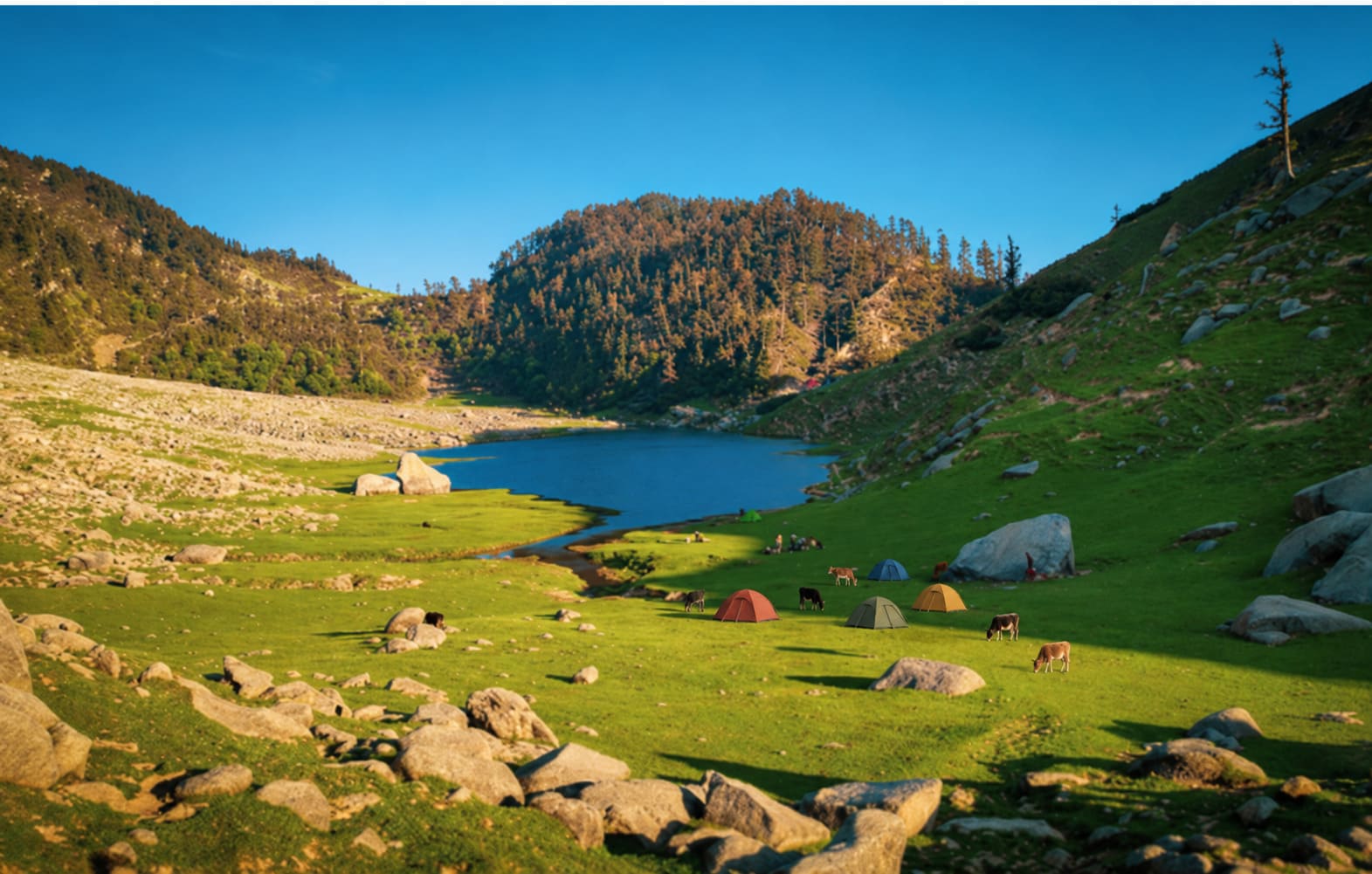
Riyoti → Kareri Lake · 1.5–3 km · 1.5–2 hrs. Trees thin, the valley opens, and the last stretch is the steepest. The lake sits in a bowl with the Dhauladhar behind it and a small Shiva temple on the bank.
Coming down · 4–5 hrs. Same way. Faster, harder on the knees, and slippery through the forest after rain.
The same trailhead also opens onto Nag Dal and the long route to Lam Dal and the Seven Lakes — multi-day, guided, above 3,500 m. The ten-day Indrahar Pass traverse comes out this way too, over Minkiani from the Chamba side.
Best time to go, and the frozen months
Late April to November for open water. October and November are the best weeks — dry, clear, the Dhauladhar sharp behind the lake.
The lake freezes from early December until March or April. Most pages don't mention it and one claims it freezes in summer. A frozen Kareri is the photograph everyone has seen, but it's a different trek: proper winter gear, snow on the upper trail, iced stream crossings, and the tea stop at the lake shut, so you carry everything.
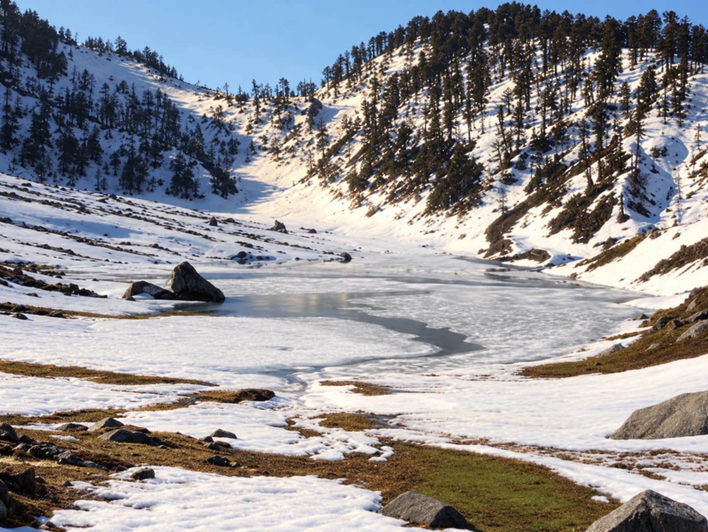
If you want it white, go mid-January to mid-February — the best time to visit Dharamshala has the snow odds by altitude.
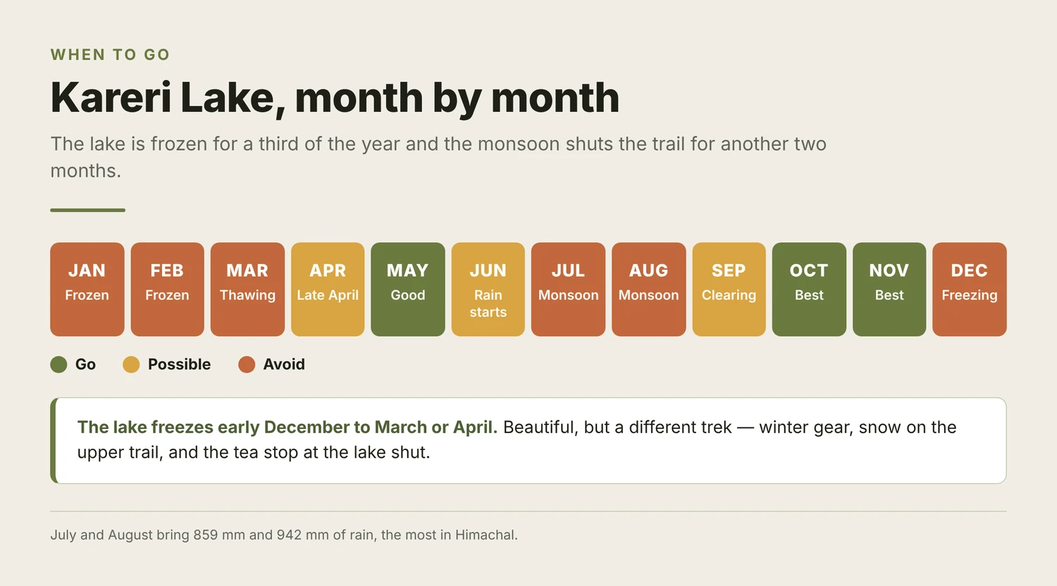
July and August are out. Dharamshala gets 859 mm and 942 mm of rain in those two months, the most in Himachal. Month by month if you're planning the wider trip.
What it costs
| On your own | |
|---|---|
| Bus to Kareri village | ~₹50 |
| Taxi instead | ₹600–1,000, split |
| Camping at Riyoti | ₹800–1,500, or free with your own tent |
| Permit | Nothing |
Guided two-day packages run ₹1,500 to ₹5,500 a head, tent, meals and guide included — local operators at the cheap end, national brands at the top.
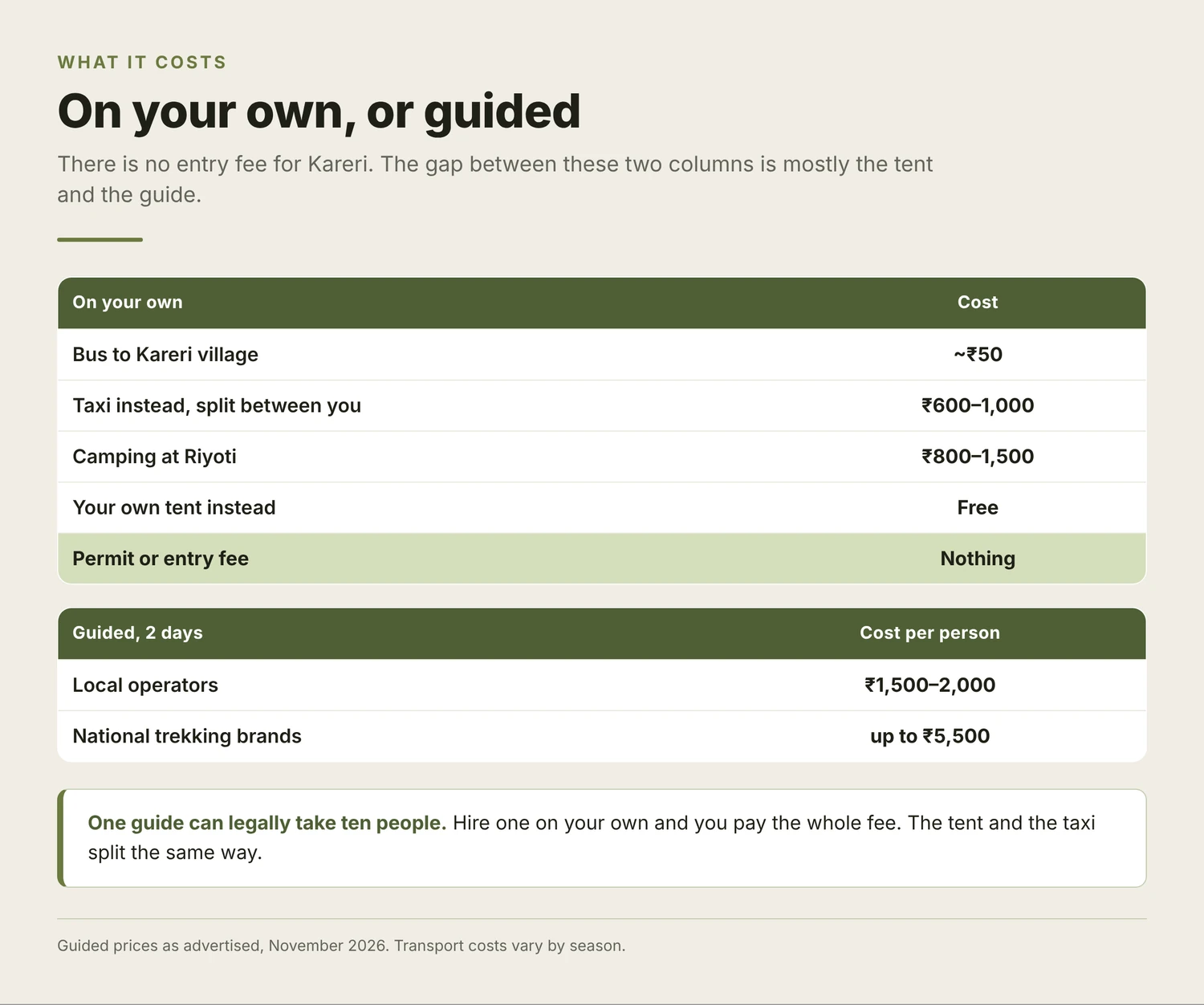
Most of that gap is the tent and the guide, and both get cheaper with numbers. One guide can legally take ten people. Walking up alone, you pay for all of it.
What to take
- Tent and sleeping bag, unless the campsite supplies them
- Warm layers in any month — 2,934 m at night is cold in June
- Two litres of water each; the stream is the only source
- Cash — no UPI, no signal past the village
- Shoes with grip. The forest descent is where people fall
- A power bank. Nowhere to charge for two days
Finding people to go with
A tent splits. A taxi splits. A guide costs the same whether two of you hire him or eight do. And with no check post at the bottom, nobody knows you're up there unless you tell someone.
Gigavent shows what people near you are actually doing this week — treks, gigs, football, open mics. Join something someone's already put up, or post your own and let people come to you.
Find a Kareri trek on Gigavent — someone's going this weekend with room in the tent, and each listing shows the date, the trailhead and how many are going. Or create your own: pick the weekend, say how many you've got space for, and anyone interested gets in touch. Takes a minute, costs nothing.
New to the valley and don't know anyone yet? How to meet new people covers the rest of it.
FAQ
How long is the Kareri Lake trek?
The Kareri Lake trek is 10 to 13 km one way, so 20 to 26 km there and back. Shorter figures are measured from Riyoti camp, not the trailhead; the 25 km you'll see is the drive from Dharamshala.
Is the Kareri Lake trek open now?
Usually, yes. The trek has no check post and nothing to apply for most of the year. In winter, when Kangra bans trekking above 3,000 m, Kareri is named as needing SP Kangra's written permission. Those orders lapse by spring, so ask locally in December and January.
How high is Kareri Lake?
The height of Kareri Lake is 2,934 metres, about 9,626 feet. You'll see 2,950, 3,100 and 3,200 m quoted elsewhere.
Is Kareri Lake frozen?
Kareri Lake is frozen from early December until March or April, fed by Dhauladhar snowmelt. For open water, go late April to November.
Do you need a guide for Kareri Lake?
No, a guide is not compulsory on this trek. The trail is well marked and plenty walk it unsupported. A guide is worth it in shoulder season with snow on the upper trail, and one can take up to ten people, so the cost splits.
Can beginners do the Kareri Lake trek?
Yes. Kareri is a common first overnight trek, as long as you can walk six hours with a pack. Go in October or May, not winter.
Ten kilometres up, a night at Riyoti, and a lake worth the early start. Carry your water, tell someone where you're going, and don't go alone in the snow.
Rules verified November 2026. Kangra's trekking orders have changed six times since 2023, so ask locally before you walk.